J. Batbaatar  hammer icon
Research

I am a geologist interested in history of glaciers and how they interact with climate to change the landscape. For my PhD thesis I focused on modern and former glaciers found in different climate regimes of Central Asia. The continental setting and a wide variety of climate zones in Central Asia provide an ideal natural laboratory to study interaction between glaciers and climate. I reconstructed past glacial extents in southern Siberia, monsoon-influenced mountains of Qilian Shan in China, hyper-arid climates of the Gobi and northern Tibet, and in the stretches of the Kyrgyz Tien Shan.

Field observations and mapping are integral part of my research. I synthesize my field observations from different regions into regional-scale interpretations using data from satellites and integrated climate data. I use ENVI, QGIS, and MATLAB to manipulate and analyze gridded datasets, such as ASTER, LANDSAT, MODIS, and NCEP/NCAR. For chronology, I used different radiometric dating methods depending on the sample: cosmic-ray exposure dating (10Be and 26Al) for rocks, luminescence (OSL, IRSL) dating for sediments, and radiocarbon dating for organics. The dated rocks and sediments are used to interpret glacial expansions, for which I explored their sensitivity to climate using numerical models. The detailed descriptions of my research and the resulting publications are listed below.

Glaciers in the continental climates of Central Asia


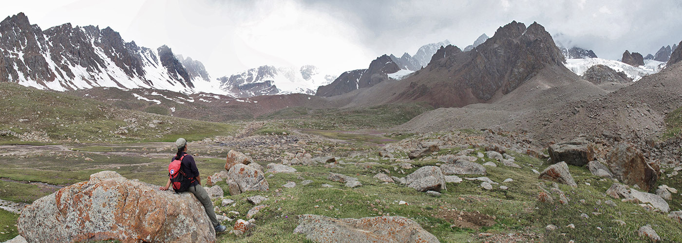
Water resources and agriculture in large regions of Central Asia depend on melt water from the glaciers, many of which are retreating in today's climate. Some of these glaciers may pose major hazards because they may release outburst floods. In recent years the monitoring of these glaciers has improved thanks to automated stations and repeated satellite imagery. However, these records are extremely short compared to response time of glaciers to changes in climate. One way to recover information about the long-term response of glaciers to climate is to reconstruct past glacial expansions and compare them to past changes in climate. To better characterize the natural variability of glaciers, we selected several glaciers under similar climate conditions in the Altai mountains, Tian Shan, Qilian Shan, Altyn Tagh, and Kunlun, and dated at least one sequence of moraines at each site. The dated moraines are used for the reconstruction of past glacial extents, which allows for a comparison with the modern glaciers under modern climate settings. We extended our study with data from the literature to complete a regional-scale survey of modern and past glacier expansions in Central Asia.


Mapping land-surface temperature to detect permafrost


Permafrost is degrading under current warming conditions, disrupting infrastructure, releasing carbon from soils, and altering seasonal water availability. Therefore, it is important to quantitatively map the change in the extent and depth of permafrost. We used satellite images of land-surface temperature to recognize and map the zero curtain, i.e., the isothermal period of ground temperature during seasonal freeze and thaw, as a precursor for delineating permafrost boundaries from remotely sensed thermal-infrared data. The phase transition of moisture in the ground allows the zero curtain to occur when near-surface soil moisture thaws or freezes, and also when ice-rich permafrost thaws or freezes. We propose that mapping the zero curtain is a precursor to mapping permafrost at shallow depths. We used ASTER and a MODIS-Aqua daily afternoon land-surface temperature (LST) timeseries to recognize the zero curtain at the 1-km scale as a “proof of concept.” Our regional mapping of the zero curtain over an area around the 7000 m high volcano Ojos del Salado in Chile suggests that the zero curtain can be mapped over arid regions of the world. It also indicates that surface heterogeneity, snow cover, and cloud cover can hinder the effectiveness of our approach. To be of practical use in many areas, it may be helpful to reduce the topographic and compositional heterogeneity in order to increase the LST accuracy. The necessary finer spatial resolution to reduce these problems is provided by ASTER (90 m).

  • Batbaatar, J., Gillespie, A.R., Sletten, R.S., Mushkin, A., Amit, R., Trombotto Liaudat, D., Liu, L., Petrie, G., 2020. Toward the detection of permafrost using land-surface temperature mapping. Remote Sensing, v. 12, 695. 2020. (crossref, pdf, supplementary 1, supplementary 2.)
  • Batbaatar, J., Gillespie, A., Sletten, R., Mushkin, A., 2019. Mapping the zero curtain duration. Temperature-Emissivity Separation Working Group, 50th US-Japanese ASTER Science Team Meeting, June 12, 2019, Tokyo, Japan.


Asynchronous glaciations in arid continental climate


The timing and the magnitude of the maximum glacial extents around the world are known to be highly variable (Gillespie and Molnar, 1995). Numerical models (Rupper and Roe, 2008) of Central Asian glaciers have attributed this heterogeneous pattern to differential sensitivity of glaciers to changes in temperature and precipitation. Particularly, in cold, arid regions sublimation can account for more than 50% of the glacier ice loss. These "starving" glaciers are more sensitive to small changes in precipitation, unlike glaciers forming under higher precipitation which are strongly controlled by temperature. To test this hypothesis in the field we sampled moraines of glaciers in the two different climate regions of Mongolia: 1) relatively humid setting (~400 mm/yr) in the central massif, the Hangai ranges; 2) Arid setting (less than 200 mm/yr) in the Gobi-Altai ranges. A single small ice cap remains in the Hangai ranges now, but glaciers there advanced more than 30 km during the global Last Glacial Maximum (LGM: ~20 ka). In the Gobi, however, we found an evidence of local LGM advance that occurred during early Holocene, ~8-7 ka, a pluvial period in Mongolia. The preliminary calculations of the surface-energy balance suggest that despite the cold temperatures of the LGM sunlight could have provided enough energy to sublime up to ~80 mm/yr of ice in the arid Gobi mountains. During the early Holocene the increased precipitation there was sufficient enough to grow glaciers on the high peaks. Our result implicates that reconstruction of paleoclimate from glacial records in arid regions should be taken carefully. Hannah Hickey, from UW News, nicely summarized our results in a normal human language in her aricle Glaciers in Mongolia's Gobi Desert actually shrank during the last ice age.


Catastrophic floods of the Maly Yenisei river, Siberia


The third largest flood on Earth, measured by its estimated peak discharge, originated from Darhad basin in northern Mongolia, the headwaters of the Yenisei river. The outlet glaciers from the East Sayan ice field (see image above) blocked the exit from the basin and impounded up to 290 m deep lake. The lake sediments exposed on the surface dated to ~50 ka (Gillespie et al., 2008), allowing a possibility that the glaciers were not big enough during the Last Glacial Maximum ~20 ka. We extracted lake sediments from a 92 m deep borehole and recovered the deep lake sediments from ~20 ka, which also supported by our cosmic-ray exposure dating of the end moraine of the blocking glacier. Our newly established glacial chronology in the adjacent areas show that the ice fields of the East Sayan and the Hangai massif were large enough to source thick outlet glaciers during the LGM.


Cool projects I helped:

Provenance of the coarse silt fractions of the Chinese Loess Plateau

Rivka Amit (Geological Survey of Israel) demonstrated in this study that the quartz grains in the Gobi dunes are transported in short distances. In this paper, she proposed in this paper that over long time-scales these abraded silts provide the primary source for the massive accumulation of the Chinese Loess Plateau.

I conducted the reconnaissance field trip and collected the initial sand samples. Later, I organized the logistics of the main trip and participated as a collaborator, and contributed to the manuscript of the paper.


Dating of the Martian surfaces

Matt Smith (post-doc at Harvard) observed that some of the craters on Mars are faulted. In this study, he mapped the faulted and unfaulted craters and proposed a new technique to directly date the tectonic activity on Mars (or any other planetary bodies).

I counted the craters and categorized into sub-groups of faulted and unfaulted craters.